wb01727_.gif (697 bytes)

               History of the Las Cruces Trail and Adjacent Canal Area

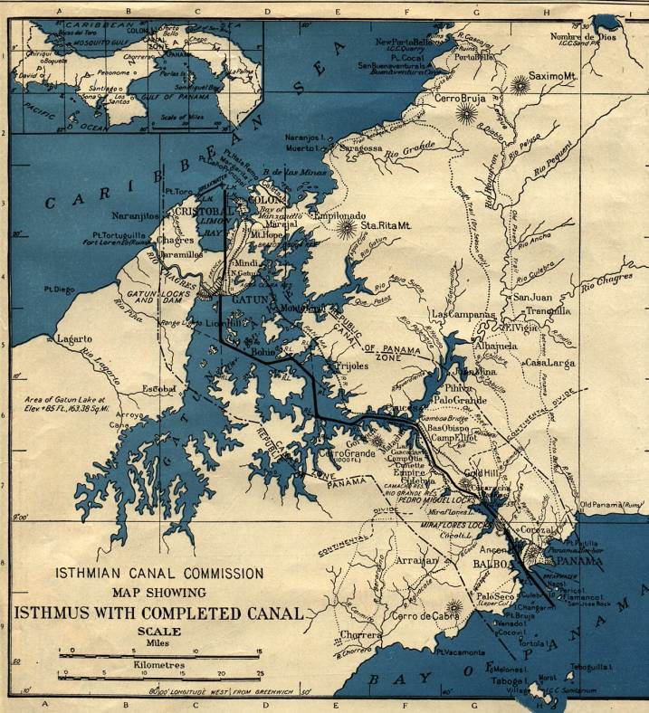
   Historic Map of Canal Area

Part 1 - Pre-History - Early Spanish Rule and Captain Drake

Part 2 - Pirates and Privateers - End of Spanish Rule

Part 3  - Panama Railroad, Canal Construction and Modern Era


 Figure 1  This is a map published in 1917, the drawing was done by
L.L. Poates Engineering Co., N.Y. 
for the I
sthmian Canal Commission map showing the Isthmus of Panama with the completed Canal.